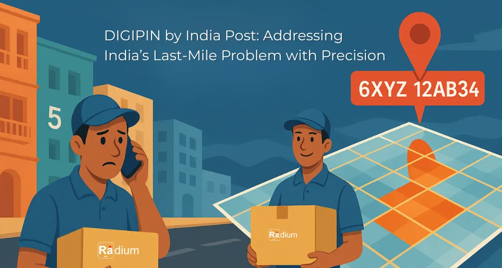
Whenever someone in India orders something online, either for an urban or rural area—be any electronics, gadgets, biometric devices, GPS, or any gift—they often prepare themselves for the inevitable follow-up call from the delivery agent. Despite filling in every detail with precision—pin code, house number, street name, nearby landmarks, and even quirky local nicknames—the call still comes.
“My house is 22/1, but the neighbor’s is 13. GPS shows a nearby field. So I explain, they get lost anyway, and this dance repeats until, with a lot of patience, the package finally reaches me.”
This isn’t a rare exception. It's a daily routine that has become a habit for millions of Indians. In cities, houses are packed into irregular patterns with haphazard numbering systems. In rural India, whole villages can share a single address pattern or be unsignposted. GPS tends to drop pins in a field halfway or behind a wall. And then the to-and-fro of phone calls, instructions, wrong turns, and delays begins.
It's a delivery nightmare not only for recipients, but also for delivery operators driving new-to-them lanes, dusty paths, and bewildering landmarks, at the expense of time, fuel, and money.
This endemic inefficiency isn't just a minor annoyance. It impacts e-commerce, emergency response services, utility deliveries, and even the functioning of government. Since decades, India's legacy PIN code system, although vital, has been wanting in accuracy to fully transform service delivery.
Enter DIGIPIN—India Post’s ambitious leap into the future of addressing.
DIGIPIN is the digital postal index number—a first-of-its-kind geo-coded digital addressing system initiated by the Department of Posts (DoP) in association with IIT Hyderabad and ISRO's National Remote Sensing Centre (NRSC). Being a part of India's rapidly evolving Digital Public Infrastructure (DPI), DIGIPIN is a paradigm shift in the way addresses are created, shared, and consumed across the country.
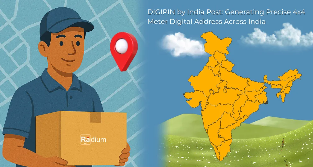
In contrast to the legacy 6-digit PIN code system—conceived decades back to categorize regions, post offices, and delivery zones over large areas—DIGIPIN provides hyper-local precision. Every DIGIPIN is associated with a unique 4-meter by 4-meter square, providing a distinct 10-character alphanumeric code to that precise grid on the map. This allows individuals, businesses, and government bodies to identify and share precise location data, regardless of whether the area is well-marked or even formally documented.
What makes DIGIPIN truly revolutionary is its universal design: it's open-source, navigable on any GPS-enabled device, easy to share, and completely inclusive of unmapped or informally addressed areas, which make up a significant portion of India's urban and rural landscape.
India Post, the global leader in the size and reach of the postal network, has more than 164,000 post offices that extend from urban metros to the most remote Himalayan villages. It has been more than a mail network for over 150 years, but also the lifeline of India's public service and communications infrastructure.
Through the decades, the Department of Posts has evolved into a multi-dimensional service organization that processes everything from life insurance schemes (PLI and RPLI) to small savings accounts, rural pensions, and wage payment for welfare schemes such as MGNREGS. It has facilitated financial inclusion, digital access, and government outreach in even the most remote areas of India.
Within this continuum of development, DIGIPIN is a natural progression—a digital upgrade to India Post's original purpose: to connect with every Indian citizen irrespective of location, language, or infrastruct
✅ Summary Insight:
“Presenting the newest addition to India's Digital Public Infrastructure (DPI). DIGIPIN will provide national coverage in India where exact locations will be represented in squares the size of a parking space. This way, anyone we provided with a DIGIPIN code can reach us at our doorsteps without needing to ask for last-mile directions.”
DIGIPIN strengthens India Post's position—not just as a service delivering parcels—but as a solid pillar of digital empowerment for the nation.
Grid-based system: The whole country is divided into millions of 4m x 4m squares.
10-character code: Each square receives a unique alphanumeric code to share via apps, messaging, or voice.
Coordinates based: The code is produced using the exact latitude and longitude of the user's location.
No personally alternative needed: DIGIPIN doesn't store names, phone numbers, or identities, simply the grid location.
Access & Usage: Visit dac.indiapost.gov.in/mydigipin/home → Allow location → Get your DIGIPIN → Share.
Although DIGIPIN supports all global navigation satellite systems—e.g., GPS (USA), Galileo (EU), GLONASS (Russia), and so on—it's particularly interesting that it works in perfect harmony with NavIC, India's own indigenous satellite navigation system created by ISRO. This makes DIGIPIN not dependent at all on foreign technologies for fundamental location services, which is a strategic win both in terms of data sovereignty and national resilience.
By enabling NavIC, DIGIPIN enables India to realize its vision of building self-reliant, secure, and scalable digital public infrastructure in line with the "Atmanirbhar Bharat" mission. It not only showcases India's tech capability but also reduces dependence on international systems for critical national services, including logistics, emergency, and governance.
The classic 6-digit PIN continues to be an essential component of India's postal system, facilitating delivery zones and areas for mass processing. DIGIPIN isn't eliminating this—it's augmenting it.
Think of it this way:
PIN Code: Locates your city, zone, or post office.
DIGIPIN: Locates your very doorstep, shop, or farm gate.
Both exist together. Together, they render addressing scalable and precise.
DIGIPIN was tailored to assist logistics and e-commerce companies, addressing one of the biggest Indian online buying revolution pain points: uncertainty of location.
Why it matters:
India's casual residential layouts and sloppy numbering create confusion.
The delivery staff prefer calls, local pointers, and approximations.
Missing deliveries mean losses, delays, and customer frustration.
DIGIPIN eliminates this confusion. With a 10-character code in their hands, delivery staff can drive directly to the 4m square where the recipient's front door is—no confusion, no calls.
|
Benefit |
Impact |
|
🔍 Improved Accuracy |
Eliminates uncertain or redundant addresses. |
|
🛻 Decreased Failed Deliveries |
Less returns, less repeat trips. |
|
📉 Lower Operating Cost |
Saves time, fuel, and labor. |
|
😊 Enhanced Customer Experience |
Instant, doorstep-level accuracy gives confidence. |
|
🚀 Quicker Growth |
Enables businesses to reach rural and far-off places with greater confidence. |
|
🔄 Simple Integration with Platforms |
Open APIs and app and platform offline support. |
DIGIPIN isn’t just about shopping—it’s about building a smarter, connected India. Its use cases span a wide range:
🏥 Emergency services: Ambulances and rescue teams can locate incidents even in unmarked areas.
🌾 Rural governance: By enabling Gram Panchayats to act effectively in welfare schemes.
🛰️ Disaster relief: Coordination of relief at the GPS level would be precise.
🧾 Digital identity mapping: By allowing the integration into the UIDAI, the electricity, the utility slates, and geotagged public registry.
🏙️ Smart cities: Relevant and appropriately matched to urban planning, electricity, water supply and drainage, waste management infrastructure.
DIGIPIN is entirely open-source and is hosted by India Post on GitHub. It has:
Code libraries for encoding/decoding
Offline usage options
Enterprise integration via REST APIs
Android and Web SDKs
Support for NavIC-compatible coordinates
This enables developers, startups, state governments, and businesses to innovate around the DIGIPIN platform with full freedom.
|
Feature |
DIGIPIN |
what3words |
Plus Codes |
|
Format |
10-character alphanumeric |
3 English words |
Alphanumeric grid |
|
Accuracy |
4m x 4m |
~3m x 3m |
~14m x 14m |
|
Open Source |
✅ Yes |
❌ No |
✅ Yes |
|
Indian Govt Supported |
✅ Yes |
❌ No |
❌ No |
|
Works Offline |
✅ Yes |
❌ Limited |
✅ Yes |
|
NavIC Compatible |
✅ Yes |
❌ No |
❌ No |
DIGIPIN can be integrated into:
Digital address fields of government forms and KYC
Alternatives to Google Maps such as MapMyIndia
UPI apps such as Google Pay and PhonePe for delivery receipt
Municipal services such as door-to-door trash collection or utility billing
Drone logistics, e.g., defense or medicine supply
The potential is vast, and the groundwork is already done
Although the platform is promising, DIGIPIN will require:
Public education and awareness
Simple-to-remember codes or sharing via QR
Expansion of existing platforms (Zomato, Swiggy, Amazon, etc.)
UI/UX innovation to simplify adoption for all age groups
India Post and partners are already engaged on these fronts.
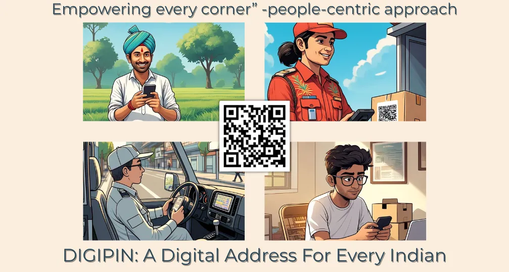
DIGIPIN is more than an addressing system for the digital age—it is digital inclusion through design, conceived with the intent to bridge India's physical and digital divides. In a nation as widespread and varied as India—where meandering village lanes intersect with unregulated urban sprawl—millions remain without official addresses. To them, something as mundane as having an item delivered, accessing emergency services, or enrolling in a government scheme can be an insurmountable hurdle.
DIGIPIN is designed to make that story different, equipping all individuals with a universal, correct, and shareable identity of location. It makes sure that each square of India—each home, shop, clinic, and farm—is locatable, mappable, and accessible with accuracy.
Whatever you do, wherever you are: student in Shillong holding out for an exam package, shopkeeper in Surat monitoring stock shipments, farmer in Latur collecting agricultural support, delivery driver in Noida attempting to deliver to a poorly signposted gated apartment—DIGIPIN provides you with clarity, consistency, and control. No guessing. No constant calls. No delays.
It's India's strong and pragmatic solution to decades of confusion of hand-scrawled instructions, superimposed addresses, and bewildered delivery routes. It introduces reason and order into what was previously chaos.
And it's not simply a private sector innovation or startup experiment. With India Post at the forefront, and with IIT Hyderabad and ISRO's National Remote Sensing Centre collaborating, DIGIPIN is a shining example of what public digital infrastructure can do—not with glitzy apps, but with profound purpose and understated power.
DIGIPIN demonstrates that when technology, science, and government collaborate with the right purpose, they can change lives at scale—seamlessly, inclusively, and sustainably.
DIGIPIN is a digital addressing of India Post, where a unique 10-character number is allotted to every 4m x 4m spot in India, enabling accurate navigation and delivery via GPS location.
No, DIGIPIN does not collect any user or personal information. It simply converts GPS coordinates (latitude and longitude) to a 10-character code that points to an exact location. There is no connection with house numbers, telephone numbers, or names, preserving the privacy of users while enabling accurate navigation and delivery.
DIGIPIN enhances the accuracy of deliveries, reduces response time in emergencies, and enables address verification. It is equally applicable to e-commerce, disaster response, smart city development, and government services (to address rural or unmapped locations). It is offline, privacy focused, easy to use for any platform because it is open source.
Yes, once an online DIGIPIN is created, it can be utilized offline. The system is meant for low-connectivity areas, and India Post's open-source code enables decoding and use without an internet connection. It's perfect for directions, deliveries, and emergency services in remote areas.

 0
0

